|
<< Click to Display Table of Contents >> Geo-referencing using Google Maps |
  
|
|
<< Click to Display Table of Contents >> Geo-referencing using Google Maps |
|
Menu: Edit | Geo-referencing using Google Maps
Geo-referencing relevés with a longitude and latitude value is easy with the build-in web browser addressing Google Maps. Use the zoom tool on the left site of the map to zoom in , zoom out and move the map to all sites. You may also use the the mouse wheel to zoom in and out and by holding the left mouse button down the map can be dragged around.
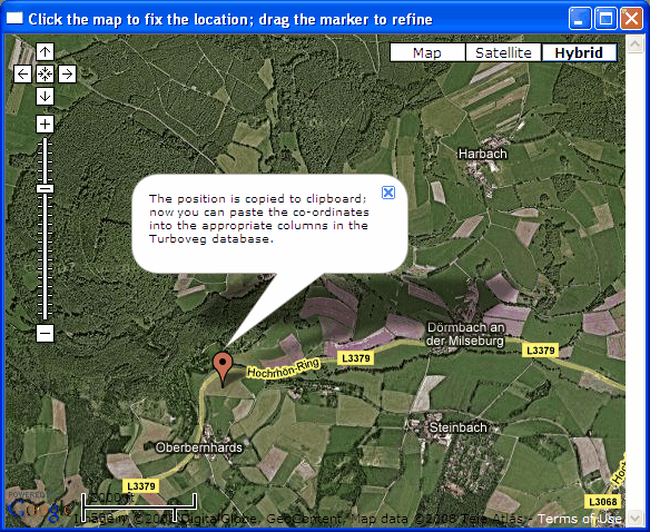
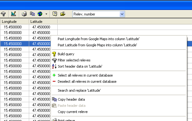
To fix a position just double click with the mouse on the site where the relevé has been recorded. A message box appears telling which further steps have to be taken. The longitude/latitude-position is copied to clipboard and can then be pasted into the table with header data (it doesn't work on the form presentation). To retrieve the values from the clipboard right click on the header data table and choose the the appropriate option in the context menu.
Make sure that columns for longitude and latitude are available in the header data table. If this is not the case then use the Modify structure option in Turboveg to add these fields. Because Turboveg wants to store the longitude/latitude values as decimal degrees, it is recommended to define both both fields as Numerical, with a width of 12 tokens and 7 decimals