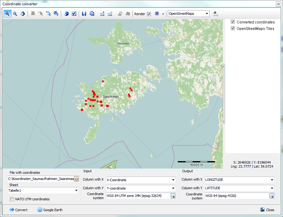
The coordinate converter allows to convert coordinates stored in an external source (e.g. Excel sheet) from one coordinate system to any other coordinates system in batch. More than 4000 coordinate systems are supported.
In case the coordinates to be converted are stored in the Turboveg3 database, another Coordinate converter should be applied.
File with coordinates: Select the file that holds the coordinates. Excel files (*.xls and *.xlsx) and CSV files are supported, as well as dbf files (e.g. Turboveg2 header data files). The first line in table is reserved for column identifiers. Click the ![]() icon to activate the file selector.
icon to activate the file selector.
Sheet: Select the sheet in the file that holds the coordinates
NATO UTM coordinates: Check this option if NATO UTM coordinates need to be converted. In this case there is only a single column with data points. Converted coordinates are plotted on the map allowing immediate checking of the validity of the conversion. If the conversion was not correct, most likely the wrong coordinate system was selected. The process can easily be repeated, each time with a different coordinate system. The input file with the converted coordinates will be automatically saved in the input folder with the name extension ' converted'.
Input
Column with X: Select the column that holds the X-coordinates. Not applicable if the 'NATO UTM coordinates' option is checked.
Column with Y: Select the column that holds the Y-coordinates. Not applicable if the 'NATO UTM coordinates' option is checked.
Column with UTM: Select the column that holds the UTM-coordinates. Only applicable if the 'NATO UTM coordinates' option is checked.
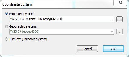
Coordinate system: Select the coordinate system in which the coordinates are projected. Click the ![]() icon to activate the coordinate system selector.
icon to activate the coordinate system selector.
In the coordinate system selector, you first need to make a choice between Projected system and Geographic system. In most cases the choice is a projected system like UTM or Gauss Kruger. For in depth information read the Wiki.
Enter 'UTM' in the edit box if a UTM projection needs to be selected and open the drop-down menu which will then show al the entries with 'UTM' in the name. To limit the selection a UTM zone may also be entered, for example '34' followed by 'N' or 'S' referring to respectively the Northern and Southern hemisphere.
Output
Column with X: Select the column that should hold the converted X-coordinates.
Column with Y: Select the column that should hold the converted Y-coordinates.
Coordinate system: Select the coordinate system to which the coordinates need to be projected. Click the ![]() icon to activate the coordinate system selector.
icon to activate the coordinate system selector.
Convert: Start the conversion.
Google Earth: Show the coordinates in Google Earth.