The purpose of this coordinate converter is to convert X and Y geographic coordinates into longitude and latitude (WGS84) for storing locations in the dedicated Turboveg3 database table. This table not only holds information on point locations, but also on geometries like lines and polygons.
In case the coordinates to be converted are stored in an external file (e.g. Excel sheet) another Coordinate converter should be applied.
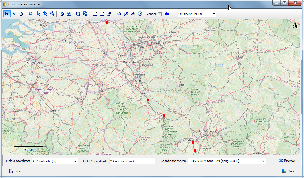
Note that plot observations have to be selected first before a conversion can take place.
Field X coordinate: Select the data field that holds the X coordinates.
Field Y coordinate: Select the data field that holds the Y coordinates.
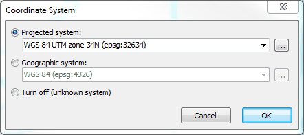
Coordinate system: Select the coordinate system in which the coordinates are projected. Click the ![]() icon to activate the coordinate system selector or enter the EPSG code directly in the edit box.
icon to activate the coordinate system selector or enter the EPSG code directly in the edit box.
In the coordinate system selector, either select Projected system or Geographic system. In most cases the choice is a projected system like UTM or Gauss Kruger. For in-depth information read the Wiki.
Enter 'UTM' in the edit box if a UTM projection needs to be selected and open the drop-down menu, which will then show al the entries with 'UTM' in the name. To limit the selection a UTM zone may also be entered, for example '34' followed by 'N' or 'S' referring to respectively the Norther and Southern hemisphere.
Preview: Before saving the converted coordinates, a visual check should be made whether the correct coordinate system has been selected and if x and y coordinates have not been accidentally swapped.
Save: Immediately save converted coordinates to the dedicated location table in the database.