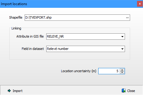
Locations by means of points, lines or polygons can be imported from a GIS file into an active dataset. Currently only ESRI shapefiles, Google KML files and files in GPS Exchange Format are supported. The import can only be successful if the coordinate system is know and if the attribute table of the GIS file contains key values that can link the locations to plots in the dataset. Links can currently only be established via Plot ID or relevé number.
Location uncertainty 0 means that the uncertainly is unknown.